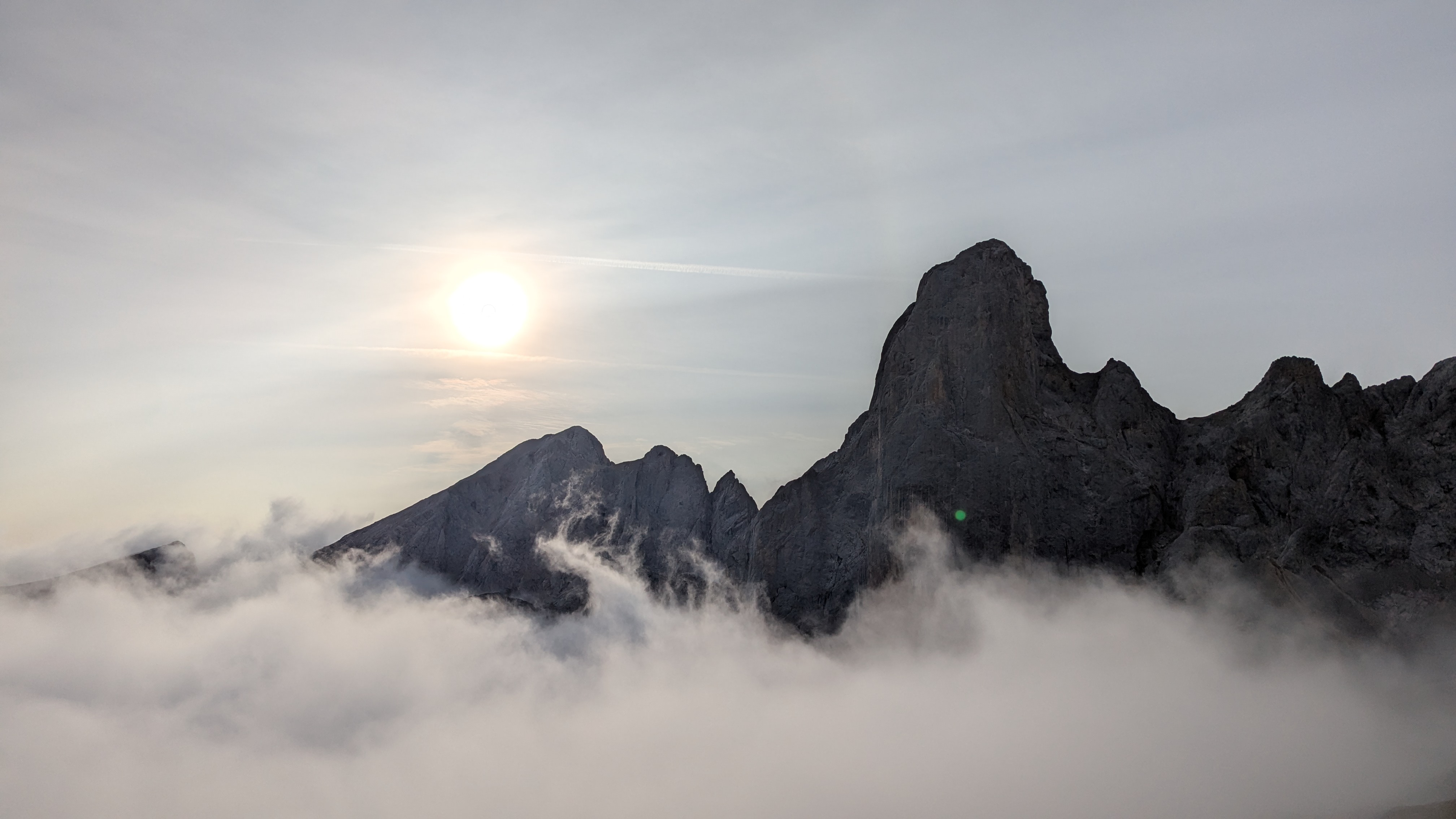
4 day guide to Picos de Europa National Park Spain. Trek through one of the more unknown national parks in Europe. Pair this trip with Guide to Basque Country & La Rioja Wine Region, Spain when you’re done to relax.

This isn’t a playground for the inexperienced or casual hiker. The terrain tests your limits and the routes toy with your navigational skills. But those who dare are richly rewarded with gasping breathtaking views. The mountain huts offer more than just a roof—they’re vibrant social hubs where you can forge unforgettable connections. This guide has crucial tips to enhance your trip and unlock the true treasures of this enigmatic park.

Planning your trip –
- When to Visit –
- September, just after the peak season with less crowds and cooler temps.
- June thru August – peak season. Summer had wildfires in the area which caused damage to trails.
- April and May – you may encounter some snowpack still melting and rough trail conditions from the winter.
- Packing List –
- Food – staying at the refugios you can book your dinner for that night, breakfast for the next morning and a to go lunch and fairly priced. I suggest you book it all. Ordering when you get there is not welcomed.
- The refugios don’t provide soap, so pack it and some face/body wipes.
- Trekking poles due to the topography.
- Rain gear for unpredictable weather.
- Sunglasses, sun block.
- Power bank and travel adapter.
- Trail mapping, I use Gaia (app).
- Cash, refugios take credit card although a 10 euro minimum
- Difficult terrain above the treeline – Don’t be fooled by its surface charm; the terrain, size, and complexity can turn your adventure into a mental and physical challenge. The unsuspecting local hikers around you may seem to make hikes look easier than they are, adding to the park’s deceptive allure.
- Park Entry points – Entry to the park seemed like a no-brainer, but that confidence was short-lived as challenges lurked around every corner of our trek from Fuente Dé. After some digging,
- Three primary entry points:
- Fuente Dé (South)
- Sotres (East) Best
- Poncebos (North)
- Those opting for the East entry in Sotres or the North entry in Poncebos are preferred. They offer a far gentler introduction to the park, meandering through lush forests.
- I opted for the South entry at Fuente Dé since we were driving in from Madrid, ready to soar into the park’s trail system via the cable car (funicular). But after we reached the mountain huts (refugio), reality of the terrain hit us hard.
- Three primary entry points:
- Topography and Trail Maps –
- With the Atlantic coast nearby and the park’s seemingly insignificant size, I expected easy hikes. The only challenge I heard murmurs of was reaching Refugio Cabrones, the park’s most elusive hut. The trail routes that should’ve been straightforward were anything but.
- Picos de Europa trails can be quite difficult. Some paths are barely discernible, worn away and treacherous—an adventure for experts.
- A trail rating system doesn’t seem to exist here. Climbing and descending rocky scrambles with pesky rock slides became our unwelcomed norm.
- Forget the safety cables and closed trail signs; we had to blow past them to reach our goals. We found ourselves teetering on loose rock trails along the crumbling precipice of a limestone mountain.
- Ultimately, we had to give in to the unforgiving terrain, which chose our paths for us.
- A mere 1 mile per hour average speed was our reality, compounded by reroutes and steep gradients.

Note – The cable car from Fuente Dé is a steal at 17 euros or 30 euros round trip. It’s an extra 16 Km hike if you don’t. Spend the 4 minutes riding the cable car. Once you reach the top, a cafe and shop are there to enjoy the jaw-dropping views. As you head into the park along the main route, don’t miss the trail split: one leads to the Refugio Veronica, while the other paves the way to the Hotel Áliva and its restaurant, perfect for those adventurers that are limited in time.
Day -1 Fuente Dé to Refugio Vega de Urriellu 8 Km, Reroute 10 Km 6 hours

The route to Refugio Veronica is deceptively straightforward, but don’t let that fool you. Once you reach Refugio Veronica, the adventure really begins as you face the choice to head towards Refugio Cabrones or Refugio Urriellu.

We booked our first two nights at Refugio Vega de Urriellu. Shortly after you split towards Refugio Uriellu from Refugio Refugio Veronica, you’re met with a daunting descent into a massive bowl. Signage warns that this route is dangerous, with the safety chain system removed and “expert only” posted. We had to go through it before sunset. We had to accept the treacherous rock scramble, where trail markings are scarce and the views below are nothing short of terrifying. One slip could send you plummeting hundreds of meters to a painful demise.

Mentally unprepared for this level of trekking, the unease settled in thick. After about an hour later, back on somewhat level ground and rejoined an established path leading to a second bowl. Descend cautiously and traverse its edge. Climbing out, you’ll finally get breathtaking glimpse of our refugio, nestled in the shadow of the imposing Uriellu mountain.
Refugio Vega de Urriellu
Refugio Uriello is largest of the mountain huts in Picos, serves as an introduction to the hut system in the park. Communal bunk rooms filled with 24 fellow adventurers, across 4 bunk rooms. Bathrooms are a common area without showers or hot water. The tap water is drinkable, but go ahead and filter it if that makes you wish. The dining and common areas buzz with stories and laughter, a perfect spot to forge new friendships. When the sun dips in the afternoon, grab a beer, a glass of wine, or whatever small offerings are available, and relish the breathtaking views as the mules trudge in with supplies from Bulnes.


Day 2 – Urriello Area
Morning rains crushed our exploratory spirit, since yesterday’s downpour revealed my aging rain gear failed. We had grand plans to conquer the trails to Bulnes and Poncebos in preparation for the famous Ruta de Cares.
Ruta de Cares closed (2025) from wildfires in the summer had wreaked havoc in the gorge, closing parts off due to the threat of rock slides. The afternoon cleared for a few hours, we trudged East for a glimpse of the North Coast of Spain before the rain returned.
Day 3 – Ureillu to Cabrones. 4 Km, 3 hours
With Ruta de Cares closed and our conversations with the local hikers, we chose to hike straight to Refugio Cabrones, fully aware that we may be forced to navigate detours. The route launches you directly into a grueling ascent from the Refugio Uriello hut to the intimidating mountain ridge looming to the North. A ladder scramble up a slot thrusts you onto the ridge, where you’ll traverse precariously for a while before reaching the high pass into another bowl. The remaining journey is a wild canyon descent punctuated by one last brutal climb out of a bowl, finally unveiling the elusive Refugio Cabrones.
Helicopter Rescue
The harsh reality of potential injury hit us hard just as we arrived. A helicopter rescue mission was taking place at the Cabrones peak. Out here, it’s either self-rescue or prepare for an airlift. You must have a crystal-clear understanding of your limits and experience level, or you risk becoming just another cautionary tale in the wilderness.

Refugio Cabrones
Refugio Jou de los Cabrones is the most remote and the smallest Refugio in Picos De Europa National Park, it serves up views that your dreams crave. Nestled in the shadow of the imposing Cabrones peak, a must-visit for any rock climber, this spot isn’t for the faint of heart.
You can tackle several routes to reach the Refugio, whether you journey from Bulnes or Uriellu. With a capacity of just 20 beds, don’t wait on your booking—this place fills up fast! The small yet inviting dining/common room showcases intriguing articles about the Refugio and its dedicated staff. We saw Jorge, the intrepid soul running the show, hauling supplies up from Bulnes. Prepare for rustic conditions, just one outhouse for a bathroom, no hot water, and the chilly water supply comes straight from below the Refugio. They do offer multiple tent camping spots for those who dare!

Day 4 – Refugio Cabrones to Fuente Di. 8 Km. Reroute 13 Km 8 hours
Last night, after wrestling with some rough translations with local hikers, the original route was going to be difficult. The straightforward path on the map was ridiculously steep and beyond our preparedness levels.
The first half of the hike was a grueling ascent and descent through three bowls, each rising a punishing 200 – 400 meters. Loose gravel and treacherous pitches contested our every effort. When we arrived at the trail split for the high pass we aimed for, we were confronted by two trail runners who had advised against the steep route. Instead, they recommended an around-the-bowls detour, leading us to the initial bowls we traversed on day one.

This meant we needed to conquer the closed/expert-only rock scramble from day one. This added a soul-crushing extra 5 kilometers to our reroute. We craved exploration, not retracing steps but, we were at the mercy of the relentless terrain. The allure of a shorter, high-risk trek was tempting, yet survival and avoiding injuries took precedence. With another six days planned in Basque country, we couldn’t afford to be reckless. After facing down our nemesis the rock scramble, we cautiously tackled it in about an hour, climbing roughly 300 meters.
Our final ascent concluded with a lengthy stroll on the main trail back to the cable car, giving us plenty of time to stew over how brutal this entire experience was. Next up: Bilbao, where a shower and some tapas await our beleaguered souls.

Reflecting on these 4 days
Our choice to venture above the treeline may have been our biggest blunder. While we were busy chasing lofty peaks, those savvy hikers who start from Sotres or Poncebos enjoyed the simplicity of a straightforward route and forest views. Starting from Fuente Dé, the cable car whisked us up, but did it truly take us where we needed to go? The guide books at the refugio teased us with alluring views of the park, all while there was splendor laid hidden below the treeline. And sure, the two refugios we stayed at perched well above the trees gave us incredible views and perspective! Yet, despite the ups and downs, it was an unforgettable adventure that sharpened our skills for the next round.
